Introduction:
In 1996, the Wisconsin Department of Transportation (DOT) transferred the deed on 112 acres in southern Oconto County,  where they had recently completed a
wetland mitigation project. This transaction was a fortunate one for WWA, as there were a limited number of assignments like this one, and this sort of transfer to a non-profit entity are no longer common place. The mitigation work created a large pond with several islands, and lowered the elevation of the northern-most portion of the property more than 20 feet, with all of those tens of thousands of yards of fill material being used for the expansion and improvement of I-43 and US 41 in and around the Green Bay area – some 15 miles to the south.
This original 112 acres includes two upland “40’s”, with significant tree cover, that meet each other at the northeast corner of the southern “40”, and the southwest corner of the northern “40”. To the north of the eastern “40” is an additional 32 acres, which includes the entire wetland mitigation area (view the map of the Abrams Property project here). Immediately adjacent to the west of the mitigation parcel is a parcel of private land, held by another, and another 30-some acres of wetland forest that the DOT still owns. We have received confirmation from the Green Bay office of the DOT, that this DOT parcel is open to the public for hunting, as well (6/11).
In April of 2011, WWA was contacted by the descendants of a local family, to see if we were interested in accepting a donation for an additional 40 acres of land, adjacent to the southern-most boundary of our current holdings. Conditions for the proposed transfer included protecting the land, in its deed, so that it can never be developed, and will be open for the public to enjoy. WWA accepted the deed to this addition in July, and thus the WWA Abrams property has grown to 152 acres in our ownership, with nearly 200 acres available for public recreation – including the adjacent DOT holdings.
Over the years, WWA volunteers created signage identify a rough parking area near the north-east corner of the wetland mitigation site, and some limited maintenance was done on the property. This limited approach changed in late 2010, as members of the Green Bay Chapter discovered the property, and began to develop plans to improve the conditions of the property, and enhance its usability for disabled hunters, and the general public.
Over the course of the winter of 2011, more than two dozen wood duck nesting structures were built and installed, then in May, a controlled burn was executed on the highlands surrounding the wetland mitigation. Later that summer, working in partnership with Challenge the Outdoors, a packed-gravel parking lot was built, along with the first leg of a hard-surface trail, and the placement of the first of several planned disabled-accessible hunting blinds – the beginnings of several years worth of phased improvements totaling more $150,000. Since undertaking the expansion and improvement of this property, WWA has enjoyed the partnership of many individuals and groups, who have provided expertise, services, products, discounts, and financial support. Check the listing below – we’d love to add your name, or the name of your business or organization to the list. Feel free to contact us at info@wisducks.org, to find out how you might help.
Property maps & rules:
The Abrams property is open to the public for hunting, or other low-impact recreational purposes, including but not limited to: hiking, bird-watching, photography, snowshoeing, and more.  We know the property is used extensively by many species of ducks, geese, ruffed grouse, pheasants, squirrels, rabbits, coyotes, wild turkeys and white-tail deer. Access is made by the improved parking lot just of US 41 northbound, just past the US 41/US141 split, or by the unimproved parking area off Oak Orchard Road, near the south eastern corner of the property.
REMEMBER: the WWA Abrams property is neighbored to both the east and the west, by private landowners. DO NOT ENTER private property without first obtaining permission.
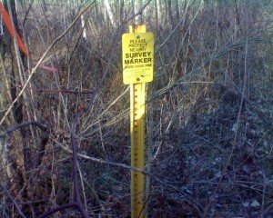
The location of the survey marker –indicating the junction point between the northern and southern segments: N 44 47.165 W 088 02.373 Do not travel south east of this point, or you will be trespassing on neighboring property.
Motorized vehicles of any kind are prohibited past the parking areas, on both ends of the property (powered wheelchairs or other mobility devices excluded). No trucks, ATV’s or motorcycles, past the parking areas. Signs indicating this prohibition are clearly posted.
Note: WWA reserves the right to temporarily close the property, with 12 hours notice via signs, for significant management works, or for our WDNR “Learn to Hunt” events – where new hunters learn from expert mentors – the in’s & out’s of pursuing various game species. These closures will be very short in duration, (<48 hrs) and infrequent.
Please: while enjoying the WWA Abrams property, please haul in any garbage that you find, or you create. There are no garbage or recycling containers on the property, and it is incumbent on all of us to take the initiative to help clean up any extraneous wrappers, shell hulls, or other garbage that might occur. Help us keep this property a shining example of what outdoors minded people can do together!
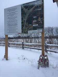
There are large format maps posted at both the north and south parking lot areas, near the trail heads, as well as the property rules. Additionally, you can easily download and print your own, here, using these tools:
WWA Abrams Project Property Map 1.25.16
Disabled accessibility features:
There are two hard-surface parking lots, which each have designated disabled-reserved parking spots, and an observation platform found adjacent to the northern access point, which is designed for roll-on access, as well as approximately 1/2 mile of hard surface trail extending from the north access, and 1/4 mile extending from the south access. As of the the end of 2015, there are three accessible waterfowl hunting blinds to access the mitigation pond area, and two enclosed accessible deer/turkey hunting blinds, which are each positioned near their own food plots, for attracting wildlife. All of these facilities are found along the pathway which extends from the northern parking lot. In 2016, we anticipate adding several addition deer/turkey blinds, to be reached from trail spurs, which will be added to the main trail recently constructed, which extends north, from the southern parking lot, into the wooded upland area of the property, off Oak Orchard Road. All blinds are first come, first serve, with the expectation that if someone comes after you, who has greater physical need for the blind than you do, you’ll vacate your spot, so they may be able to utilize the blind.
Educational opportunities:
The Abrams project property is available to educators for a variety of outside-the-classroom study opportunities. We have hosted groups from grade-school age, through middle & high school students, as well as Boy Scout troops and college students from Fox Valley Technical College. With the mix of wetland, upland, and forested habitats, including three areas featuring intensive managment practices: an area adjacent to Brookside Creek, which has been restored for northern pike spawning purposes, an area north of Oak Orchard road, which has been cleared with a forestry mower to provide improved habitat for woodcock, and a wetland scrape project, built in the south west corner of the property, there is no shortage of different landscapes for learners to explore. For more information on how you might utilize the property in your outdoor learning plans, please feel free to contact us at info@wisducks.org.
Friends of Abrams:
In May of 2019 WWA put out the call to those interested in creating a Friends of Abrams group to assist the organization in moving forward into Phase 5 of the project. Read all the details here.


